Those of you who take public transit know the feeling. You show up to catch your bus or your train on time, or early if you’re like me, only to find it late. Google feels your pain, and is introducing some new functionality into Google Maps.
“Often when I’m taking public transit,” Google software engineer Sasha Gontmakher said in a blog post. “I arrive at my stop on time only to anxiously check my watch and look down the street for my bus, which is running late once again. Those extra minutes I’m forced to wait seem like an eternity, and the only information I can access on my phone is when the bus was supposed to arrive.”
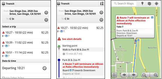
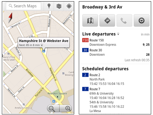
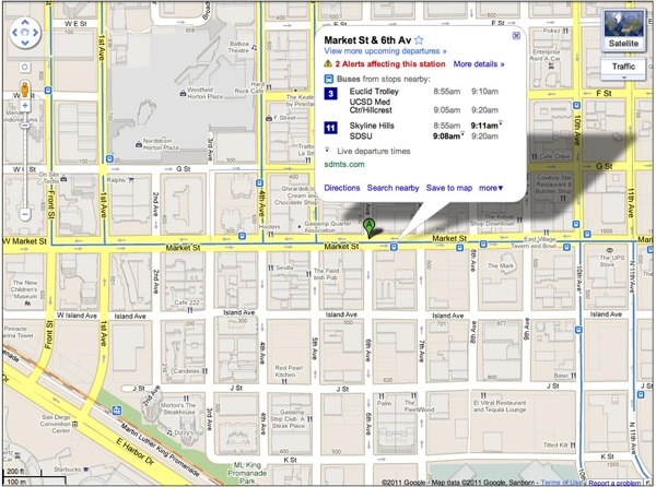
When you select a transit stop in Google maps, you’ll see “live departure times,” estimated departure times based on service alerts affecting particular routes. Some examples are accidents and construction work on a certain bus route. You’ll also know if a bus is being detoured or terminates prematurely.
You’ll also see the amount of time the trip will now take with the delays factored in while punching in directions in Google Maps, as well as service alerts.
These alerts are available both on Google’s Google Maps Android App as well as on the desktop and mobile Web versions. The live transit information is currently available in San Francisco, Portland, Ore., San Diego, Madrid and Turn. Google says they’re working on adding more cities to the list. People who use public transit as a green and convenient way to get around will appreciate this feature, if only to stop wondering why that bus is late yet again. You’re still on your own fumbling for exact change in your pocket when the bus finally shows up, though.
We covered an app based on Google Maps called Mapnificent that helps you find places to go on public transit. If you drive instead, JustDrive is an app that may help keep you safe. If you prefer to just walk, you can make some money with Gigwalk.


