One of the enduring images of the U.S. space program is seeing the Earth from space. Now NASA has improved upon that with Blue Marble Next Generation.
It’s hard not to see an image of the Earth from above and not be moved. All the differences between people and nations down here seem so petty and trivial once you see all our borders disappear. You can understand why Stewart Brand lobbied for NASA to release the original image of the Earth back in the ’60s and put on the cover of his Whole Earth Catalog, which was Pinterest for hippies.
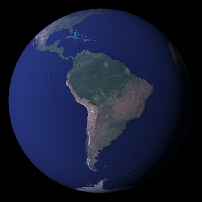
NASA’s new project allows anybody to see the Earth with the clarity only astronauts have seen so far. Actually, you probably have a better view of our planet than most astronauts.
The space agency has released the high-resolution photos in celebration of their new Earth Observation System. (Well, maybe not exactly new, but 2005-ish vintage. But space is pretty awesome no matter what year it is.) It comprises 18 satellites snapping detailed pictures and beaming them back down to scientists.
They have images over all 12 months of the year 2004. Although you’ve probably seen many images of the Earth whether in books are documentaries, but it’s pretty cool to watch what the vegetation does as the seasons change in the temperate zones, going from dead to green.
Advances in computer technology allowed NASA’s Earth Observatory to make composites of all the images shot over the month, which helped alleviate some of the noise that show up when taking these pictures. And they aren’t just Photoshopping these images. That would take too long even for the most advanced photo-editing junkie. The agency put its considerable computing resources that Uncle Sam gave them to process them automatically.
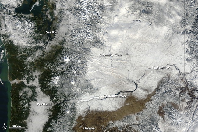
They also have more recent images available. Here’s a brutal winter that went through the Pacific Northwest, not far from where I live:
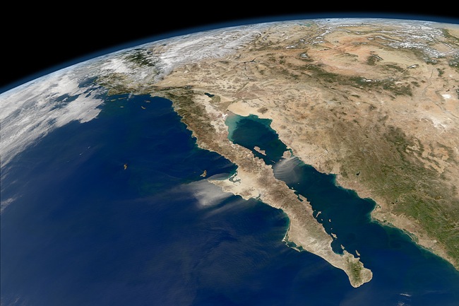
Most of the images are weather-related. Here’s one of Baja California in Mexico, with some dust storms visible.
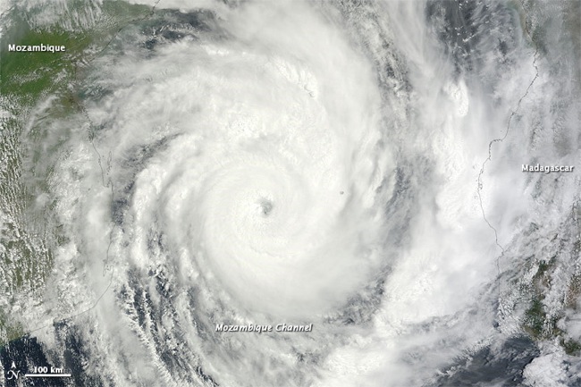
And of course, the obligatory hurricane shot. Actually, it’s Tropical Cyclone Funso.
There’s greater detail in area like glaciers, deserts, and areas with snow cover, things that haven’t always shown up well on satellite pictures. The images are much sharper overall than anything that even the best cameras could capture back in the ’60s and ’70s. The astronauts took Hasselblads to the moon, so NASA knows good cameras when they see them. Sure, we have Google Maps on our phones, but even they don’t have the kind of detail that’s available. Things like salt flats look even better and more like actually looking down from the International Space Station.
NASA does admit to some drawbacks. You might see some noise in open water areas. Tropical regions have cloud cover that make getting the composite imagery exactly right in those areas difficult. Satellite imagery is by no means perfect, as awesome as it looks here. You can get images in all kinds of resolutions here. You can even download them via Bittorrent.
You might also be interested in NASA’s GENIE suborbital rocket system. As mentioned previously, astronauts used Hasselblad camera on the Moon. Here’s a pinhole version.


